Hello again!
Sorry it has been over a week from our last blog post, but we have been hiking in the beautiful Torres Del Paine National Park and have not had the chance to find wifi. Since our last post, we have successfully crossed our first boarder into Chile, met back up with our Swiss friends and hiked many amazing trails!
At the end of our last post, we were in Rio Gallegos, the southernmost city on mainland Argentina. From here we had to a make a decision, continue south to the end of the world at the city of Ushuaia or start heading west into Chile to start our hiking. In order to get to Ushuaia, we would have to cross into Chile, put our truck on a ferry across the strait of Magellan, cross back into Argentina and then finish the drive south to Ushuaia. Once in Ushuaia we would spend 3-4 days exploring the city, seeing penguins and hiking a bit in Tierra del Fuego National Park. In total this option would be about a weeklong. Our other option was a one-day drive to the west to the boarder of Chile, cross into Chile and then go to the famous hiking area Torres del Paine and hike there for a week. It was a very tough decision to make. On one hand we were already so far south, and it would be cool to see the end of the world but on the other hand, we could have more time hiking in Torres del Paine. After doing a lot of research on what each place had to offer and on the weather for the next week at both places, we decided to travel west and spend a week in Torres del Paine. The decision came down to the quality of hiking and the weather. Tierra del Fuego has some good hiking but nothing in comparison to Torres. Also, the weather in Ushuaia looked terrible for the week, 40 degrees and rain every day, while Torres looked much nicer. With this decision made, we started west.
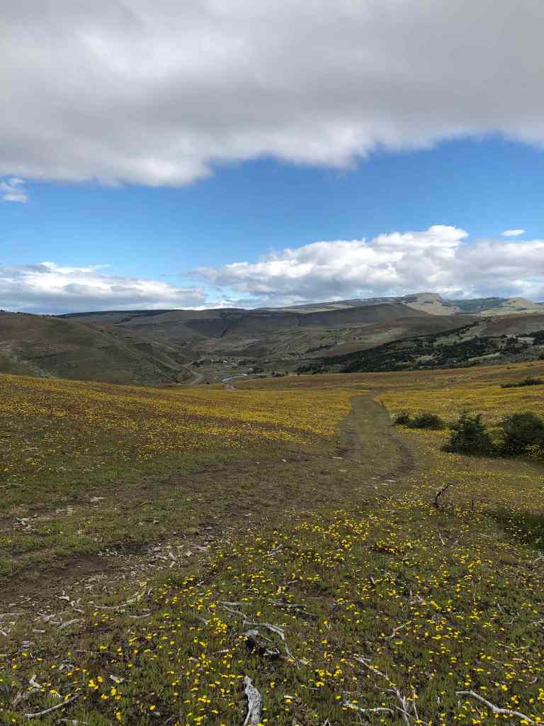
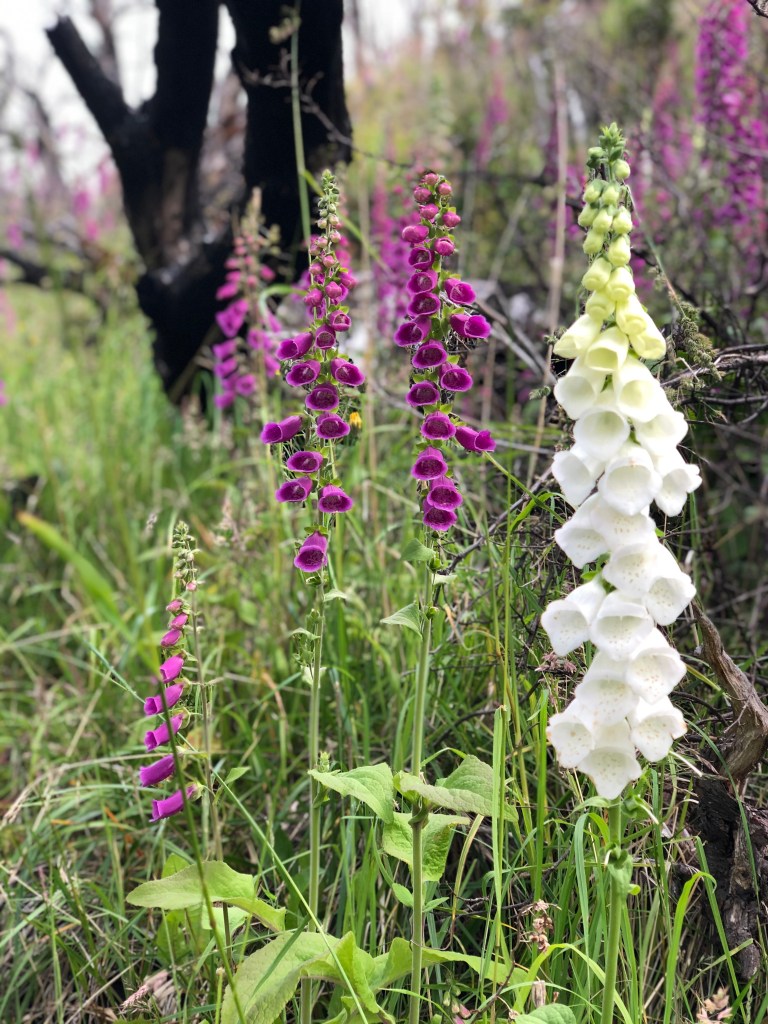
We were a little worried about our first border crossing, just because we didn’t fully know how it works. We knew we had all the correct paperwork for ourselves and for the car and we also knew fresh fruits and vegetables were not allowed across the border. Because of this, we chose to spend one last night in Argentina, right at the border so we could finish off the rest of our fruits and vegetables. When we were within 20 minutes of the border, we started looking for camping spots. Normally we use the app iOverlander to find camping spots but when we were about 1 mile outside of our chosen campsite, we saw a very steep dirt road leading up a hill. Immediately, Nikki said, “Let’s go up there!” Just recently on our trip to Namibia with Nikki’s family did Nikki learn of her love for off-roading and I could tell from the excitement in her voice, that at some point today, we were going to try our hand at getting up that steep hill. We did buy the off-road version of our truck after all and we needed to use it! We found the start of the off-roading trail and decided to go for it then. Upon approaching the hill, we realized how steep it was! It seemed like a trail the local town used for ATVs and dirt bikes. We slowly crept up the first section and both our eyes grew big. One vehicle length up the hill we stopped to reassess our decision. We were both a little nervous on how leaned back we were, but we really wanted to see what was on top of the hill. We decided to go one more vehicle length and see how it felt. Upon reaching our next stopping point we had both realized our truck had no problem with this hill and it was just our inexperience making us nervous. The truck climbed so smoothly that we didn’t even stopped at the next vehicle length and instead powered up the rest of the hill. Once at the top, we were rewarded by a huge meadow of yellow and white flowers! We also had an amazing view of the surrounding hills. We loved it so much up there, we found a small ravine sheltered by trees where we spent the night. We were proud of finding our first campsite on our own and not just following the overlanders who came before us. In the morning we continued to be proud as we added our campsite to the iOverlander app. Once we had settled in, we made a huge feast of all our remaining vegetables and fruits. We made a big vegetable stew that lasted us for many days.
The next morning, we drove the last 20 minutes to the Chile border and easily cruised through the exit of Argentina and the entrance to Chile. The only hiccup we had involved losing two pounds of dried beans and lentils to customs. We knew fresh foods were not allowed but didn’t expect dried beans to be an issue. With the border crossing behind us, we made our way to Puerto Natales, the nearest town to Torres del Paine and the starting spot for everyone wanting to hike in the region. This town was full of tourist from all over the world preparing to hike. The town had hostels and outdoor gear stores at every corner. It seemed almost as if English was the official language of this town. We spent two days in Puerto Natales just working in a coffee shop with wifi to plan out the next leg of our journey. From this planning, we chose 7 hikes we wanted to do in Torres del Paine. After planning and some grocery shopping, we drove 2 hours north to start our week in the park.
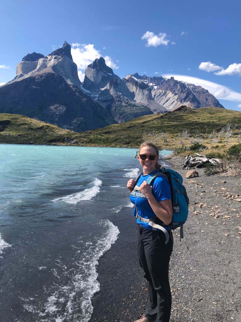
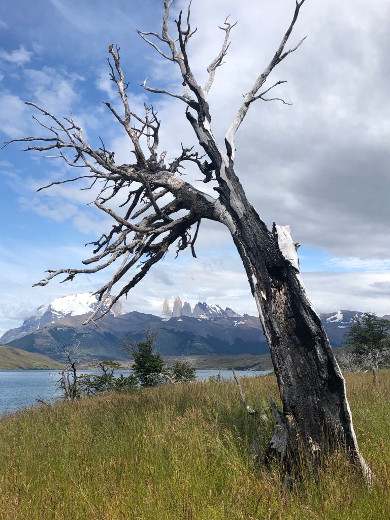
The main thing you should know about the park is that it contains two very famous backpacking trails, the W and the O. The O is a longer loop trail that allows for access to every part of the park while the W is a slightly shorter version that hits the highlights of the park. The hard part about doing these trails, is that there are designated campsites along the trails that must be booked way in advance. Nikki and I had looked into this before leaving Buenos Aires and had decided not to do either of these trails due to how crowded and expensive they were. For these campsites, the prices were around $44 to $80 a night! Instead of booking these campsites, we found a way to hike most of the W trail as day hikes and sleep in our camper. This way we could hike 80% of the trail but sleep for free in our bed. The cost of hiking in Torres del Paine was a reoccurring comment of ours. Everything about the park is aimed at international tourists. Every cost was substantially greater for tourists, which I am totally ok with, but the weird part was the privatization. Parts of the park were owned by private hotels or companies that couldn’t be accessed unless you were staying at that hotel. Parts like that were a bit weird but overall, we loved the park!
Our first hike was to mirador Ferrier (Mirador is Spanish for viewpoint). This trail was a relatively short trail at 6 km roundtrip, but the elevation gain was impressive. In just 3 short km, we gained 600 m of elevation! Our legs were burning as we reached the viewpoint! Unfortunately, the weather was not cooperating with us and heavy clouds obscured our view of the famous torres (Spanish for towers). This was a great starter hike that really showed us the consequences of eating empanadas, steak, ice cream and drinking wine for the last month in Buenos Aires. All this hiking for the next 3 months is really going to kick us into shape again!

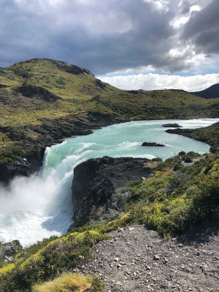
Our next day was also another warmup day of hiking consisting of two smaller hikes to viewpoints. These two were to mirador condor and mirador cuervos. Both provided amazing viewpoints of the stereotypical Patagonia landscapes. The hike to mirador condor was a short 2 km up but the crazy wind made it feel more like 6 km. Neither of us had felt wind like this before. At one saddle, the wind howled through the narrow saddle gap and the gusts had the power to knock us over if we were not prepared. Some of the gusts even visibly pushed us backward as we struggled through the windy gap. The view from the top was spectacular though! It provided a full 360-degree view of the mountains and lakes of the park! Even though the wind was almost knocking us over, we huddled down behind a boulder and stayed to enjoy the view for a while. After finishing that hike, we drove a short distance to our other hike for the day, mirador cuervos. This hike was also very short, about 6 km in total, but is very popular due to having two distinctive viewpoints. The first viewpoint was salta grande, a large waterfall. While this waterfall wasn’t very tall, the amount of water pouring over it was impressive at 1000 m3 a second! After the waterfall, the trail led to a viewpoint over a beautiful lake with views of the mountains. This viewpoint was much less windy, so Nikki and I took a 30-minute nap in the sun here.
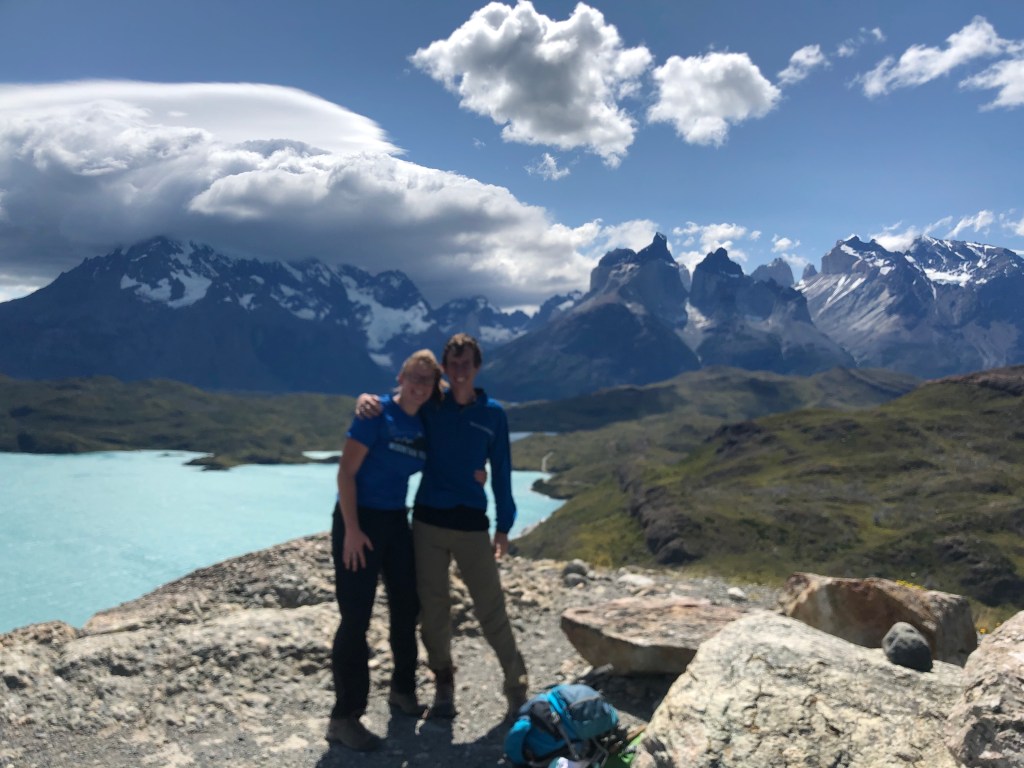
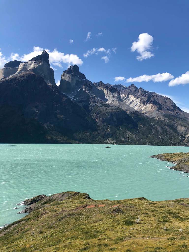
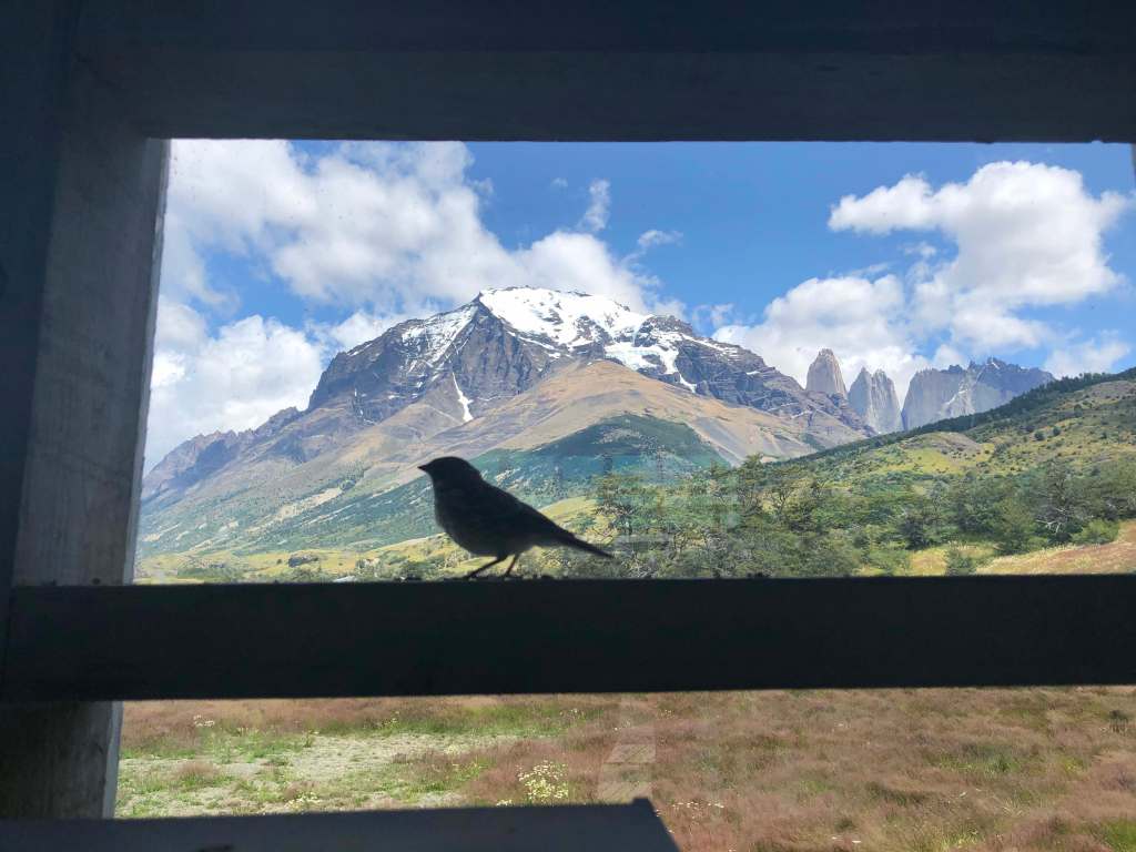
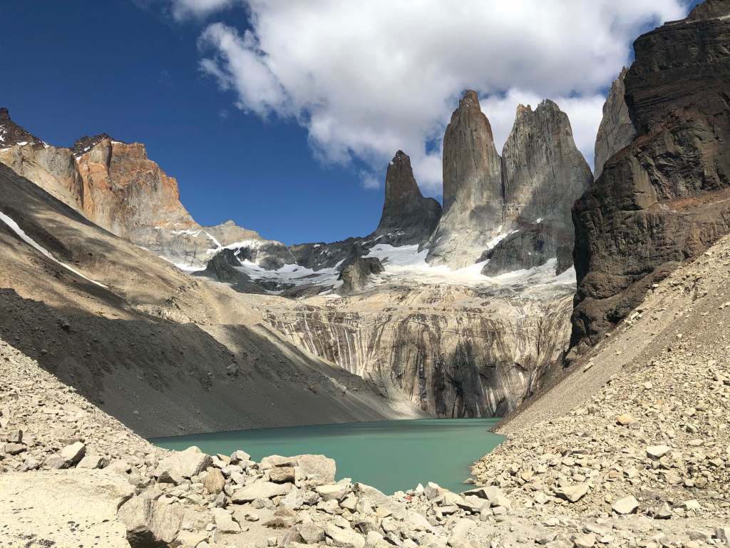
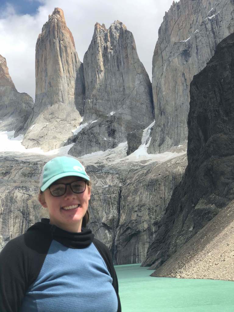
After our two hiking warmup days, we were feeling ready to get onto the real hiking! The next day we met up with our Swiss friends to hike the most famous viewpoint in the park, mirador Torres. The hike culminated into a view of the famous towers the park in named after but to get there involved a 10 km uphill hike full of people. Since this is the most famous hike in the park, the trail was extremely crowded for a 12-mile hike. We started early in the morning and arrived at the peak at noon. The hike itself was very pretty and diverse with sections of windy passes, emerald forests and boulder scrambling but the view at the end really was the reason for hiking. The granite volcanic inclusion towers rise up above a stunning glacial lake. We were very fortunate to have a clear day so we could see the full view. Many days, clouds roll in and obscure the tops of the towers which would be a huge bummer since the hike is pretty grueling with a total length of 14 miles and 2400 feet of elevation gain. While we loved the views, we did not like how crowded the hike was. While having lunch at the top, about 100 other people reached the summit. We are just not used to hiking with so many people, but overall it was our favorite day of the trip so far.
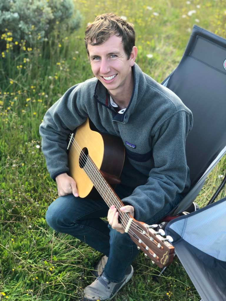
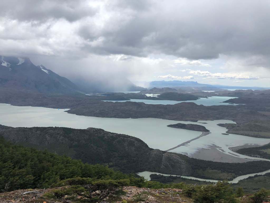
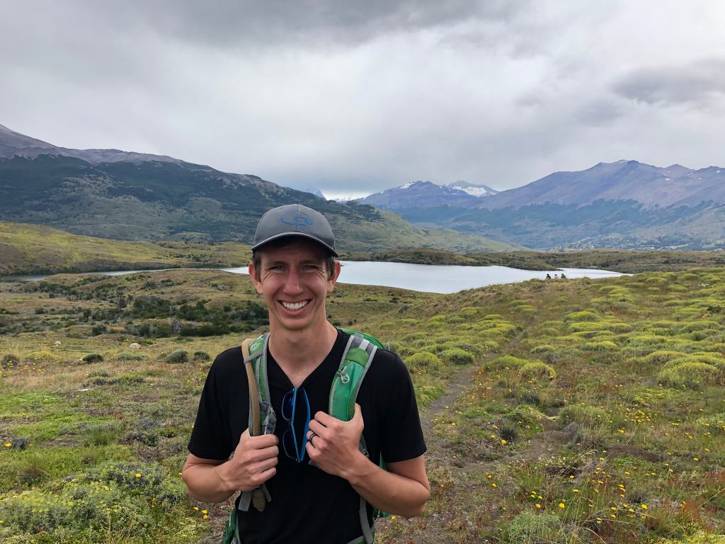
Feeling energized by our long hike the day before, the next day we ventured on another 14-mile hike, but this time with much less people. A good thing about having a couple of very famous hikes is that the other less famous hikes are basically empty. We chose a hike around lagoona azul and lagoona cebolla because it was on a side of the park very few people go to. This hike was beautiful because it gave a new perspective of the torres. We hiked around these lakes but always had the peaks in the background. It was really great to escape the crowds for a day. We only saw two other groups on this hike. Even though this hike was still long, 14 miles, it had little elevation gain which made for a very enjoyable hike. The miles of hiking were adding up though and our legs and feet were needing a rest. The following day we had planned another 12-mile hike along the famous W-trek, but both our bodies and the weather had other plans. Waking up, our legs and feet were very sore, and a large storm had rolled in overnight to completely obscure the peaks. We decided a rest day was warranted. We spent the day reading and playing music while our little home protected us from a continuous drizzle. We later learned that the drizzle actually turned to blowing snow up on the trails! We felt so cozy and relaxed bundled in our warm home!
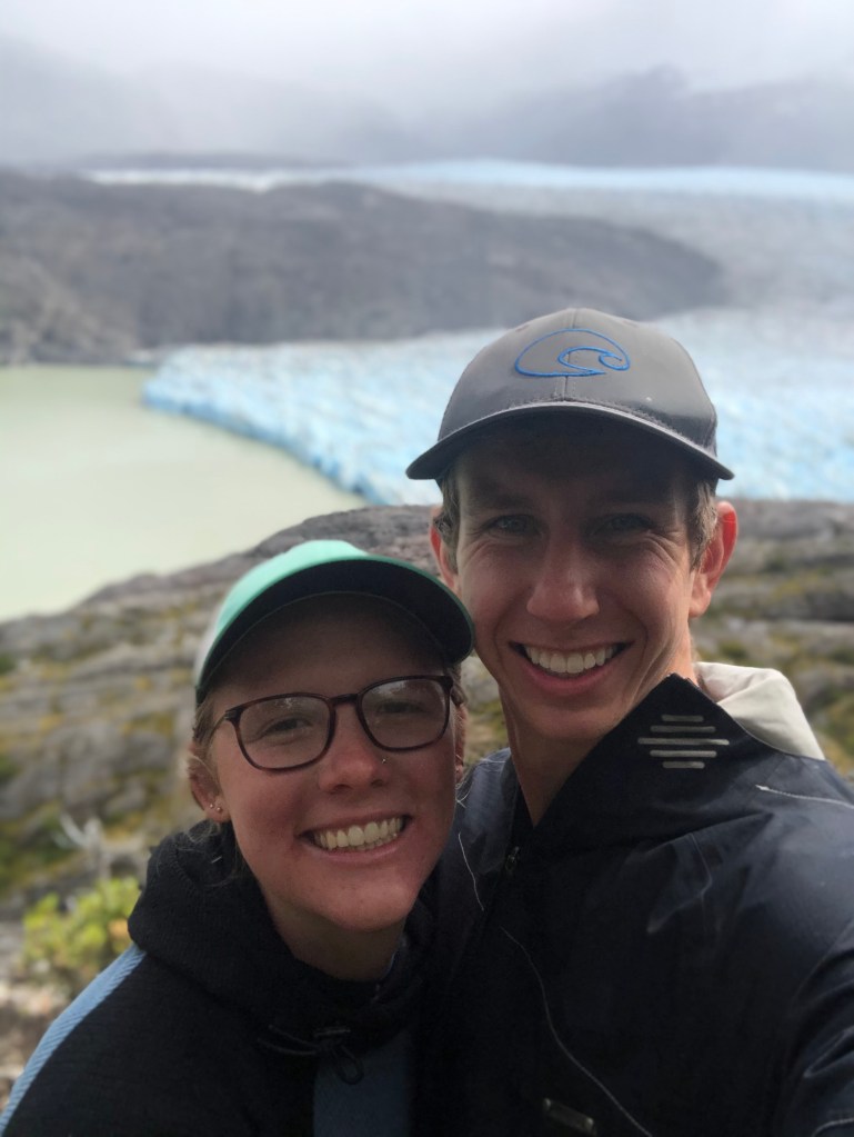
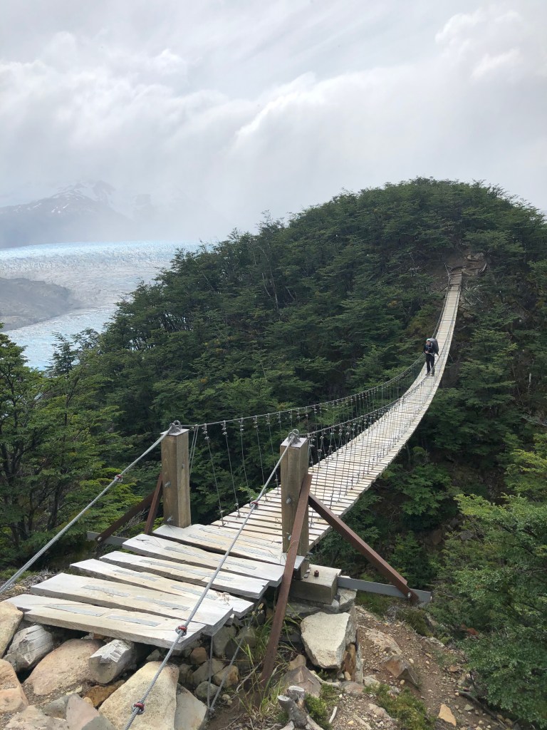
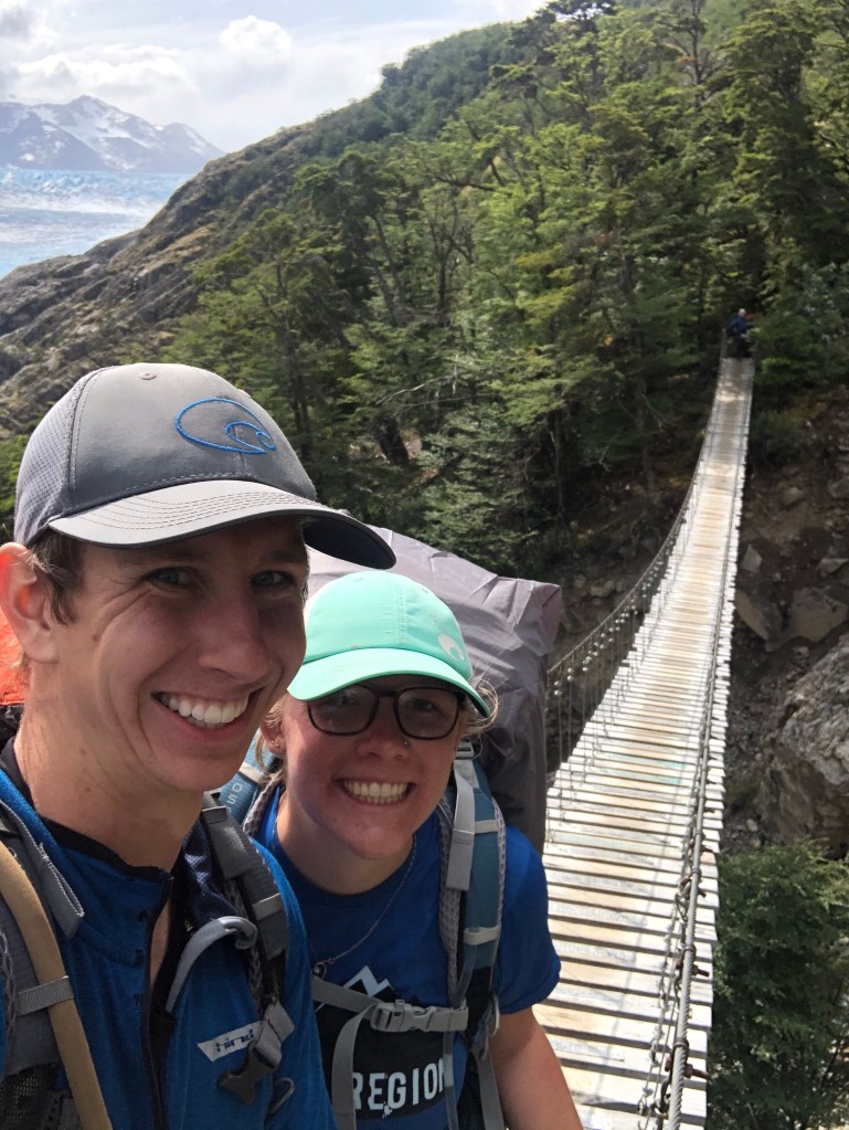
The following day we planned on doing a small one-night backpacking trip on the southern arm of the W-trek. We wanted to hike to Gray Glacier and two suspension bridges but to do this in one day required taking a ferry to the trailhead, hiking 12 miles to the bridges and hiking the 12 miles back in time to take the ferry back. We decided this was too much for one day and instead booked a campsite at the glacier to split the hike in two. The first day we took the ferry and completed the first 12 miles arriving at Gray Glacier and the two suspension bridges. The view of the glacier was spectacular! The ice was beautiful due to numerous shades of blues against the murky gray color of the lake. This glacier is part of the third largest ice sheet in the world only dwarfed by Antarctica and the Greenland ice sheet. The two bridges were also a sight to see! Both were narrow wooden suspension bridges that spanned a considerably long and deep gap! The combination of a sign saying a 4-person maximum on the bridge and the wind swaying the bridges, made crossing the bridges a nerve-racking but exciting experience! We spent that night peacefully sleeping in our tent surrounded by a hundred or so other tents. In the morning we woke up early to get a head start on our hike back down. We made it back down in time to catch the 11:00 am ferry back to our truck. We were very happy with our decision to split this hike in two. We would not have been able to hike the 24 miles in one day and enjoy the experience. Once back at the car, we had finished all our planned hikes for Torres del Paine so we drove back to Puerto Natales for a much deserved shower and hot dinner! We slept that night near the border since our destination for the next day was the town of El Calafate in Argentina.
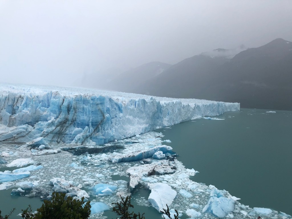
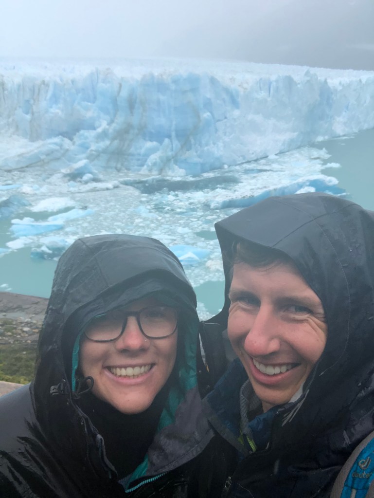
The crossing back into Argentina was uneventful and we arrived in El Calafate in the late afternoon. El Calafate is other very touristy town in the Patagonia region due to its proximity to Perito Moreno, arguably the most famous glacier in the world. This glacier is famous due to being one of the only advancing glaciers in the world and because of this, the frequency at which ice calves off its face and falls into the lake below it. Even though this glacier is advancing, the ice sheet is also thinning at the same time so in total the glacier is still losing mass. In town, we restocked our food supplies and slept along the shores of Lago Argentino. Early the next morning we drove to Perito Moreno glacier with the goal of spending the full day there watching large ice chunks break off the glacier. This part of the national park doesn’t have any real hiking trails but instead has a couple of miles of raised boardwalks used to view the glacier. Unfortunately, as we arrived at the glacier, a steady rain had started. We had already paid our park entry fee and had no other plans for the day, so we bundled up in all our rain gear and set out on the boardwalks. The glacier really was spectacular, and we could see why so many people make a trip here. We could walk so close to it and really see all the intricate layering and colors of the ice! Also, as advertised, ice really did calve off and fall into the water! The glacier face has a total height of 80 meters, so when ice fell from the top, it made a huge splash and sound! In the rain, we walked almost all of the boardwalks and in total saw about 7 different ice calving events. A fun part of this was hearing the deep ominous sound of ice moving and cracking and quickly scanning the face to determine if and where the ice would fall! It turned into almost a game where we could guess where the next big ice chunk would fall from. The size of the ice chunks varied from the size of a large pumpkin to the size of a small house! At the start of our walk, we were basically walking alone due to both our arrival before the tour busses and the persistent rain. As the morning progressed, more and more people arrived but the rain kept most people huddled under a few covered viewpoints. With our ample raingear, we were able to have the closest viewpoints to ourselves. We sat and watched the glacier for a couple of hours fully enjoying its magnitude and beauty. After about 3 hours in the cold rain, we decided to wait for one more ice falling event before heading back to our warm and dry car for lunch. We are so glad we decided to wait for one more event. Only about 10 minutes after deciding this, a huge chunk the size of a house fell from the highest point of the glacier and cascaded down the face into the water! The sound was deafening! Furthermore, it fell from the exact point I guessed a large piece would fall from! I contribute part of this guesswork to my civil engineering training. Thanks Professor Corotis for the structural engineering knowledge! Feeling rewarded for our patience in the freezing rain, we happily walked back to our dry truck and drove to a viewpoint to eat our packed lunch and make some hot chocolate to warm up!
After lunch and a short nap, we drove back into El Calafate to relax for the rest of the day in town and plan our next destination, El Chalten. El Chalten is one of the hiking capitals of Argentina and we are so excited to hike there! The Fitz Roy mountain range around El Chalten is the iconic image of Patagonia and is actually the inspiration for the Patagonia clothing brand symbol. We are currently now en route to El Chalten and I am hoping to find wifi strong enough to post this blog! My goal is also to post the next blog in a prompter timeline in about a week, after we have finished hiking in El Chalten. I have realized the hardest thing about these blog posts in finding wifi strong enough to post them.
We hope everyone is doing well and are thinking of you all!
Until next time,
Nikki and Colter
